My bus was leaving Akureyri at 8:30 am leaving time for Google to lead me to a bakery open by 7:30. The place it selected was a building that looked very like the nearby offices of Avis, KPMG and others, but inside the pastries and rolls were laid out on glass shelves and a group of older gentlemen were chatting over their breakfast at a nearby table. After coffee, ham filled croissant, an Icelandic doughnut and Skyr, I walked to the bus stop. Arriving a little early I admired the nearby display of poster sized photographs on an Arctic theme. While looking at a photo of the inside of a ladies hut in the north of Russia, meat dripping blood onto the floor, I noticed a small minibus sitting by the bus stop with "79" and the letter "S" in its window. "S" for Strætó the name of the bus company. After the driver had squirted antiseptic gel on my hands I joined an older couple on the minibus. They left at Laugar, so for the rest of the journey I was the sole passenger.
Húsavík is known for its whale watching trips, and people were lining up on the quay to board boats. After purchasing a salt encrusted ham roll I left town on a road going east. I had chosen this route as the current bus service ends at Húsavík, leaving me the choice of hitch hiking to Ásbyrgi or walking (a taxi was just too expensive to consider for just me). On purchasing a hiking map (which later dissolved in the rain) I discovered the Bláskógavegur trail, an old pack horse route, headed in the required direction, starting after a length of road. On the map the road was a thin line, I assumed a gravel road serving a few outlining farms but instead it was two lanes of new black tarmac. I walked along it for almost 20 kilometres, a few cars passed, and a cyclist, but for most of the time I was a solitary, insignificant person walking alone, dwarfed by views of lakes, lupins and mountains as I slowly made my way over a watershed.
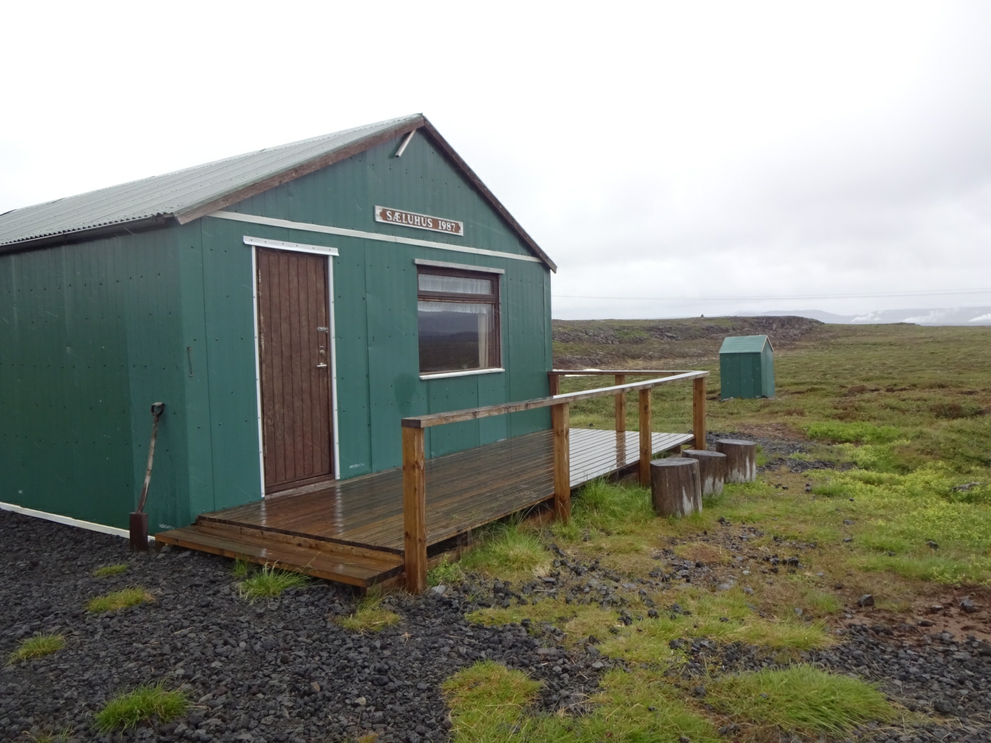
I left the road to follow a track by electricity pylons to reach the tourist hut at Sæluhúsmúli. The hut door was unlocked, inside there was a table, benches, a double decker sleeping platform and a variety of mops, cloths and cleaning products. As it had been raining for a few hours it made a comfortable place to eat my lunch. I contemplated spending the night there as the rain showed no sign of stopping, but as it was a little after 2 pm, there would have been a lot of time with little to do before bedtime. So, cleaning away my footprints as I backed towards the door, I left to continue my walk.
From the hut I was following waymarks on my GPS that I had copied down from the Internet, these led me along the Bláskógavegur. Over the day I saw two signs for the trail, not enough to be helpful given the junctions with other tracks. At first I was following vehicle tracks but then the route branched off onto a path. Footprints suggested the main users were horses and sheep. With the continuing rain and the churning effect of the horses hooves I was often slithering on mud. As the surrounding vegetation of low creeping, dwarf birch growing on hummocks was not easy to walk on I was condemned to slide on the narrow sunken path. Although there were some low hills and patches of rock, lava with a ropey pahoehoe surface, the area was pretty flat. I was close to the rift between the European and American plates and I assumed the lava was quite recent.
At around 5 pm Àsbyrgi was still 17 kilometres away in a straight line, and with the path taking a wiggly line, I was not going to get there tonight. Due to the low twiggy bushes I had trouble spotting a place to pitch my tent but at 5:30 a grassy patch proved too good to miss and I made camp for the night.
As I write this the rain continues, I hope it will stop tomorrow but the forecast is non-committal.


No comments:
Post a Comment